Lake Geneva Rustic Roads and Fall Color Drives
Walworth County has 7 designated Wisconsin Rustic Roads, as many as any county in the state, and 6 of them sit within about 20 minutes of downtown Lake Geneva. They run from 2 miles to 10.3 miles, all are signed in brown and yellow, and the speed limit never goes above 45 mph. Snake Road, the one most visitors have heard of, is officially Rustic Road 29.
The whole set adds up to about 30 miles of designated road. You can drive all 7 in a long afternoon, or you can do the good half in 90 minutes.
Here is every route, what it costs you in time, and which ones are worth the drive in October.
What a Wisconsin Rustic Road Actually Is
A Wisconsin Rustic Road is a lightly traveled local road officially designated by the state Department of Transportation for its scenery, native vegetation, and rural character. The Legislature created the program in 1973 and the first road was dedicated in 1975. Routes are marked with distinctive brown and yellow signs, carry a maximum speed limit of 45 mph, and range from 2 miles to 37 miles long. WisDOT has designated more than 120 routes covering roughly 760 miles across 61 Wisconsin counties.
It is a real designation, not a tourism slogan. A town has to nominate the road and the state has to approve it, and the criteria are specific: outstanding natural features, rural character, and light enough traffic that the road stays that way.
The practical effect for a driver is the part that matters. A Rustic Road is a road somebody decided should stay slow. No shoulders to speak of, no passing lanes, no development pressure.
Two things to know before you go looking:
Follow the signs, not your map app. They are brown and yellow with the R-number on them. The roads keep their local names, so your phone will say Cranberry Road and never mention Rustic Road 36.
45 mph is the ceiling, not the target. Several of these are posted lower, and a few of them earn it.
The full program, including maps for every road, is on the WisDOT Rustic Roads pages.
All 7 Walworth County Rustic Roads
Walworth County has 7 designated Rustic Roads: R-11, R-12, R-29, R-36, R-85, R-120, and R-126. Together they cover about 30 miles. R-11 is the longest at 10.3 miles and R-120 is the shortest at 2 miles. All are paved except R-36, which has both paved and unpaved sections. R-29 is Snake Road in Lake Geneva, and R-126 near East Troy is the newest, dedicated in November 2023.
| Road | Miles | Surface | Where it runs | Nearest town |
|---|---|---|---|---|
| R-11 | 10.3 | Paved | South, Steel, Spring Valley, Knob Hill Rds, between WIS 50 and WIS 36 | Lake Geneva, east |
| R-12 | 5.7 | Paved | Back Rd, Sheridan Springs Rd, Spring Valley Rd, Church St | Lyons |
| R-29 | 2.7 | Paved | Snake Road, a loop off WIS 50 | Lake Geneva |
| R-36 | 3.6 | Paved and gravel | Cranberry Rd and Berndt Rd, east from WIS 50 | Lake Geneva, east |
| R-85 | 2.5 | Paved | Kearney and Potter Rds, a loop off County DD | Spring Prairie |
| R-120 | 2.0 | Paved | Peck Station Rd, County A to County ES | Elkhorn, north |
| R-126 | 3.6 | Paved | Bell School Rd and part of Hillburn Mill Rd, north of WIS 20 | East Troy |
Lengths and surfaces are WisDOT’s own. Several travel sites carry different numbers for these roads, and they are wrong.
The Roads, One at a Time
R-29, Snake Road: the one you can do before dinner
Length: 2.7 miles, paved Where: A loop off WIS 50, leaving the city of Lake Geneva and rejoining WIS 50 in the town of Geneva Best for: The 20-minute version, or an add-on to a lakefront afternoon One catch: It is genuinely narrow and it is popular. In October you will be behind someone driving 15 mph with a phone out the window, and you will become that person about 4 minutes later.
Yes, Snake Road is a Rustic Road. It has been R-29 for decades, and WisDOT’s own description says it is particularly beautiful in autumn, which is a stronger word than a state highway department usually reaches for.
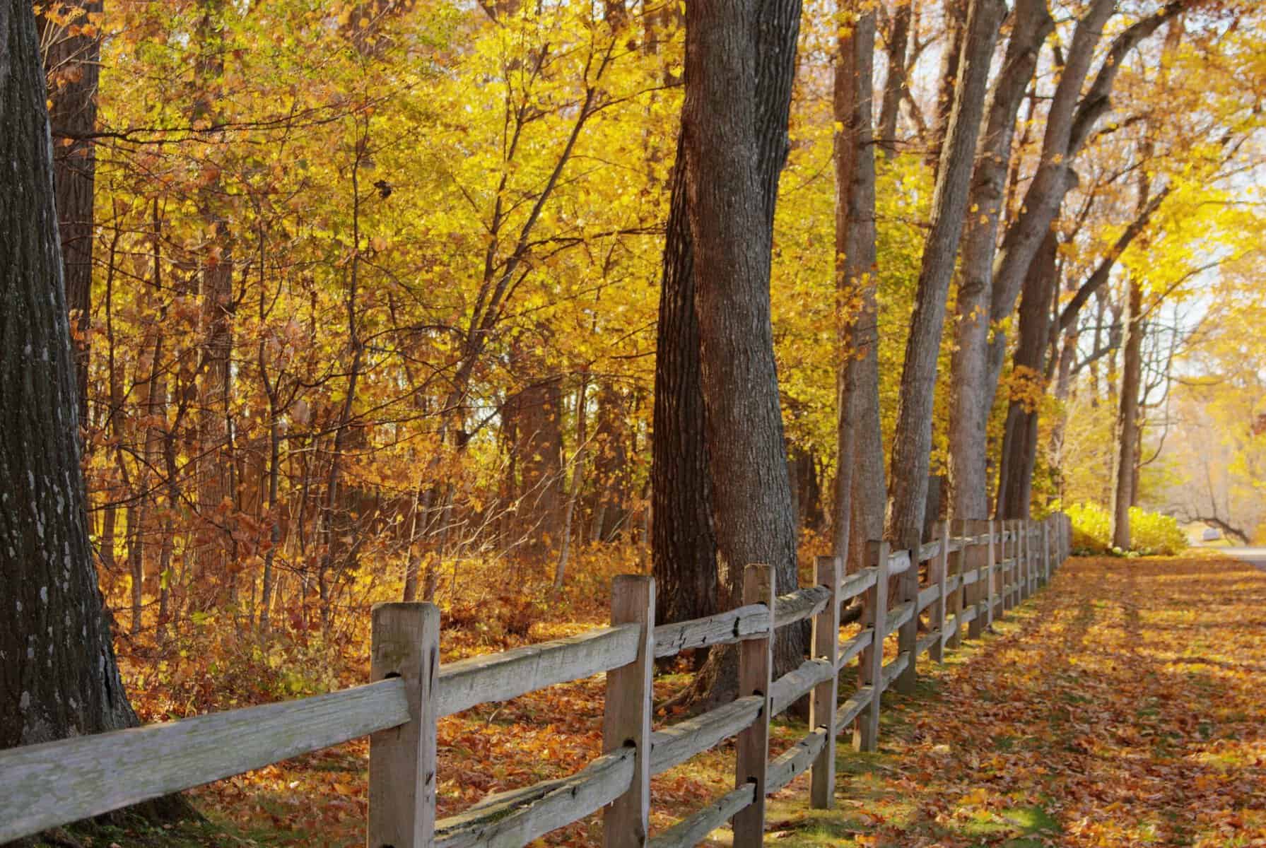
Split rail fencing in stretches, heavy tree cover, and the curves the name promises. It is the closest designated road to downtown and the easiest to fit into a day you had planned around something else.
R-11: the long one
Length: 10.3 miles, paved Where: South, Steel, Spring Valley, and Knob Hill Roads, between WIS 50 and WIS 36, east of Lake Geneva Best for: The drive that is actually the point of the afternoon One catch: 10.3 miles at 30 to 40 mph with stops is closer to 40 minutes than 20
This is the best single road in the county for glacial terrain. WisDOT describes it as gently winding with views of Kettle Moraine topography, running through large stands of oak, maple, and hickory.
Oak and hickory are the reason this one holds up late. Maples go bright and drop fast. Oaks turn rust and copper and hang on for weeks, so R-11 still reads as fall well after the postcard trees have quit.
R-12: the one with the river and the village
Length: 5.7 miles, paved Where: Back Road, Sheridan Springs Road, Spring Valley Road, and Church Street, between WIS 50 and WIS 36 Best for: Variety in a short distance One catch: The curves are sharp, not gentle. WisDOT says so, and they are right.
R-12 crosses the White River and runs through Lyons, which gives you a village with old churches in the middle of a country drive. Along the way: Kettle Moraine formations, pine and spruce plantations, a tamarack swamp, and several ponds.
The tamarack is the detail worth slowing for. Tamaracks are deciduous conifers, so they turn gold and drop their needles, and they do it later than the hardwoods. A tamarack swamp in early November is doing something no maple can.
R-36, Cranberry Road: the gravel one
Length: 3.6 miles, paved and unpaved Where: Cranberry Road and Berndt Road, east from WIS 50 Best for: Getting off pavement without leaving the county One catch: Part of this is gravel and WisDOT does not say which part. Do not take a low car after heavy rain.
The name comes from early settlers who harvested cranberries out of the nearby marshes. The road is narrow and hilly, running through farmland, glacial marshes, and knobs, with a wide mix of trees and shrubs.
This is the one that feels oldest. It is also the one most likely to put your car through a puddle you cannot see the bottom of.
R-85: Sugar Creek and the Nature Conservancy land
Length: 2.5 miles, paved Where: Kearney and Potter Roads, a loop off County DD in the town of Spring Prairie Best for: Water and wetland color rather than tree canopy One catch: Short enough that it is not worth a dedicated trip. Pair it.
Potter Road runs alongside the winding Sugar Creek, and both pass through Nature Conservancy forests and wetlands. Kearney Road climbs into steeply glaciated uplands with farmland and pine woodlots.
Wetlands turn earlier than woods. If you come in late September and the maples have not started, R-85 is already doing something.
R-120, Peck Station Road: 2 miles and a wildlife area
Length: 2 miles, paved Where: Peck Station Road, County A south to County ES in the town of Lafayette, just north of Elkhorn Best for: Pairing with the Troy Wildlife Area One catch: The shortest road on the list. Treat it as the approach, not the destination.
Peck Station Road is named after a stop on the Western Union Railroad. The former inn is still standing and is now a private home, so admire it from the road. WisDOT calls the road agricultural in character and quite colorful in the fall.
At the east side of the County A intersection is the Troy Wildlife Area, which is public land good for hiking, fishing, and cross-country skiing once the snow comes. That is what makes the 2 miles worth driving. More about the town is in our Elkhorn community guide.
R-126, Bell School Road: the newest one in the county
Length: 3.6 miles, paved Where: Bell School Road and part of Hillburn Mill Road, north of WIS 20 in the town of East Troy Best for: Farm vistas rather than tree tunnels One catch: Newly designated, which means it is not on older maps or in older guides at all
Dedicated November 1, 2023 and announced by the state in April 2024, R-126 is Walworth County’s seventh Rustic Road and one of the most recent additions to the statewide program.
It runs through sweeping agricultural country with preserved farms and woodlots, and it crosses Honey Creek. The Honey Creek Streambank Protection Area along the route is 251 acres of public land open for hiking, fishing, canoeing, birding, and cross-country skiing.
The road is named for Bell School No. 7, a one-room schoolhouse built in 1853 and listed on the Wisconsin Architecture and History Inventory. It is a private residence now. Look, do not stop in the driveway. Our East Troy community guide covers the rest of the town.
The Three Roads That Connect
Rustic Roads 11, 12, and 36 physically connect to each other east of Lake Geneva, Wisconsin, between WIS 50 and WIS 36. WisDOT notes the connection on all three official road pages. Driven as one continuous route, the three cover 19.6 miles of designated Rustic Road, which is the longest linked stretch in Walworth County.
This is the thing most write-ups of these roads miss, and it changes how you plan a day.
R-11 adjoins R-12 and R-36. R-12 connects to R-11 and R-36. R-36 connects to R-11 and R-12. All three statements come off WisDOT’s own pages, and all three roads sit in the same block of country between WIS 50 and WIS 36.
So instead of three separate out-and-backs, you get close to 20 miles of continuous designated road, with a village and a river crossing in the middle of it. Add R-29 on the way out of town and you have covered 4 of the county’s 7 roads in one loop without ever getting on a highway for long.
That cluster is the answer to “we have half a day, what should we do.”
Kim and Joel’s take: People discover these roads in October and start asking a different question by November. Living out here means the drive to town is 10 minutes on a road that looks like this, and the tradeoff is a septic system, a well, and a longer commute. Both halves of that are worth knowing before you fall in love with a mailbox. Search homes around Geneva Lake and the Southern Lakes
Three Routes, Depending on How Much Time You Have
Three practical fall color routes near Lake Geneva: a 90-minute short loop using Rustic Road 29 and downtown, a half-day eastern loop linking Rustic Roads 11, 12, and 36 through Lyons, and a half-day northern run connecting Rustic Roads 120, 85, and 126 through Elkhorn, Spring Prairie, and East Troy.
The 90-minute version
Snake Road (R-29) out of Lake Geneva, back into town, park downtown, and walk a stretch of the Geneva Lake Shore Path. Coffee before or ice cream after.
Total designated road: 2.7 miles. Total actual satisfaction: higher than that number suggests, because the walk does the heavy lifting.
The eastern loop, half a day
R-29 on the way out, then east to the R-11, R-12, R-36 cluster. Drive R-11 for the glacial terrain, R-12 through Lyons and across the White River, and R-36 if you are willing to hit gravel.
Roughly 22 miles of designated road plus the connections between them. Budget 3 hours with stops, more if you get out and walk.
The northern run, half a day
Start at R-120 north of Elkhorn with a stop at the Troy Wildlife Area. Head to R-85 in Spring Prairie for Sugar Creek. Finish at R-126 near East Troy for the farm vistas and Honey Creek.
About 8 miles of designated road spread over a wider area, so this one is more driving between roads than on them. The payoff is that it is the least-driven of the three routes and R-126 is new enough that most people have not heard of it.
Each of those towns has its own page in our community guides, including Whitewater and Burlington if you keep going.
When to Actually Come
Peak fall color around Lake Geneva, Wisconsin generally arrives in the second half of October, though the exact week moves year to year with temperature and rainfall. In 2025, Travel Wisconsin observers reported Lake Geneva at 75 percent color on October 24, with some southern Wisconsin locations not expecting peak until early November. The Travel Wisconsin Fall Color Report publishes live county-level updates through the season.
Most guides will tell you mid-October and stop there. The record is messier than that, and a late warm fall can push southeastern Wisconsin into November.
Check the Travel Wisconsin Fall Color Report before you commit to a weekend. It is compiled from more than 100 local observers, it covers every county, and it publishes predicted peak dates alongside current percentages. It is the only source worth planning around.
Two things that are true regardless of the week:
Oaks buy you time. R-11 runs through oak and hickory, which hold color long after maples have dropped. If you missed peak by 10 days, that is the road to drive.
Morning light beats afternoon light on these roads. Most of them run east to west with heavy tree cover. Early sun comes in sideways under the canopy. By 2 PM you are looking at shade.
Everything else the season offers, orchards, corn mazes, color cruises, and the October events calendar, is in our Lake Geneva fall activities guide.
The Kettle Moraine Scenic Drive, If You Want a Longer Day
The Kettle Moraine Scenic Drive is a 115-mile marked auto route through southeastern Wisconsin connecting the northern and southern units of the Kettle Moraine State Forest. Its southern end is at Whitewater Lake in Walworth County, about 30 minutes northwest of Lake Geneva, and its northern end is near Elkhart Lake in Sheboygan County. The route follows county and local roads and is marked with green acorn signs.
The Rustic Roads are short. The Scenic Drive is the opposite problem.
It crosses 6 counties, and driving the whole thing is a full day at county-road speeds before you stop for anything. The Wisconsin DNR publishes turn-by-turn directions, and you want them, because the green acorn signs are easy to miss at an intersection.
The useful move from Lake Geneva is to drive the southern 20 or 30 miles out of Whitewater Lake and turn around. That gets you the glacial terrain the route exists for without committing to Sheboygan County.
Our Kettle Moraine guide covers the forest itself, and the Ice Age Trail runs through the same ground on foot.
Driving These Roads Without Ruining Your Day
Wisconsin Rustic Roads carry a maximum speed limit of 45 mph and most have no paved shoulder. In fall, the main hazards near Lake Geneva are farm equipment on the road during harvest, deer at dawn and dusk, low sun angle on east-west routes, and wet leaves on curves. Rustic Road 36 has an unpaved section that can be soft after rain.
None of this is dramatic. It is just the stuff that turns a nice drive into a bad one.
Farm equipment. October is harvest. A combine moving between fields takes the whole road and it is not going to pull over. Slow down and wait.
Deer. Rut season runs through late October and November and these are exactly the wooded corridors deer cross. Dawn and dusk are worst, which is also when the light is best. Drive accordingly.
Wet leaves. A curve with leaf litter on it behaves like a curve with ice on it. R-12’s curves are the sharp ones.
No shoulder. If you want a photo, find a driveway apron or a field entrance and pull fully off. Stopping in the lane on a blind curve is how these roads get their reputation.
Cyclists share these roads, and they are good roads for it: low speed limits, light traffic, real terrain. They are also narrow with no shoulder, which means a car and a bike cannot both be comfortable at the same time. Give the full lane.
Cell service thins out on the eastern cluster and around Spring Prairie. Download the map before you leave town.
Where to Stop Along the Way
The roads themselves have nothing on them. That is the point of them, and it means you plan the food separately.
Before you go: coffee downtown. Our coffee shop guide covers what opens early enough to matter.
Mid-drive: farm stands. The eastern cluster and the northern run both pass through working farm country, and September through October is when the stands are worth stopping at. Our farm markets and stands guide has them by town.
After: the restaurant guide for a real dinner, or the ice cream and sweet shops if the drive ran long and dinner is already handled.
The drives cost nothing, which puts them on the short list in our free things to do guide too.
Rustic Roads Worth a Longer Drive
Walworth County has 7. The counties around it have more, and a few are close enough to fold into a bigger day.
Racine County has 7 of its own: R-2, R-5, R-25, R-30, R-37, R-42, and R-43. R-43 crosses into Kenosha County, which is that county’s only designated road.
Jefferson County has R-84, R-87, and R-88, northwest of here and reachable on the way to or from the Kettle Moraine.
Waukesha County has R-10, R-86, and R-115, north toward the Kettle Moraine’s northern unit.
Descriptions, lengths, and maps for all of them are on WisDOT’s southeast region page. Between those 4 counties and Walworth there are more designated Rustic Roads within an hour of Geneva Lake than anywhere else in Wisconsin.
For the water version of the same idea, the 17 lakes around Geneva Lake sit in the same glacial country these roads run through, and several of the drives pass within a few miles of one.
Frequently Asked Questions About Lake Geneva Rustic Roads
How many Rustic Roads are near Lake Geneva?
Walworth County has 7 designated Wisconsin Rustic Roads: R-11, R-12, R-29, R-36, R-85, R-120, and R-126. That is as many as any county in the state. They total about 30 miles, and 6 of the 7 are within roughly 20 minutes of downtown Lake Geneva. R-11 is the longest at 10.3 miles and R-120 is the shortest at 2 miles.
Is Snake Road in Lake Geneva a Rustic Road?
Yes. Snake Road is officially Rustic Road 29. It runs 2.7 miles as a paved loop, leaving WIS 50 in the city of Lake Geneva and rejoining WIS 50 in the town of Geneva. WisDOT describes it as bounded in places by split rail fencing and passing through native vegetation that is particularly beautiful in autumn. It is the closest designated Rustic Road to downtown.
What is the speed limit on a Wisconsin Rustic Road?
Wisconsin Rustic Roads carry a maximum speed limit of 45 mph, set by the program itself. Individual roads can be posted lower and several near Lake Geneva are. The roads are marked with brown and yellow signs carrying the R-number, and they keep their local street names, so a map app will show Cranberry Road rather than Rustic Road 36.
Which Rustic Roads near Lake Geneva connect to each other?
Rustic Roads 11, 12, and 36 all connect, east of Lake Geneva between WIS 50 and WIS 36. WisDOT notes the connection on each of the three official road pages. Driven together they cover 19.6 miles of designated road, the longest linked stretch in Walworth County, and the route crosses the White River and passes through the village of Lyons.
Are any of the Rustic Roads near Lake Geneva unpaved?
One. Rustic Road 36, which follows Cranberry Road and Berndt Road east from WIS 50, has both paved and unpaved sections across its 3.6 miles. WisDOT does not specify which portion is gravel. The other 6 Walworth County Rustic Roads are fully paved. After heavy rain the unpaved stretch can be soft, so it is worth avoiding in a low-clearance car.
When is peak fall color on the Lake Geneva Rustic Roads?
Generally the second half of October, though the week moves year to year with temperature and rainfall, and a warm fall can push southeastern Wisconsin into early November. In 2025, Travel Wisconsin observers put Lake Geneva at 75 percent color on October 24. Check the Travel Wisconsin Fall Color Report for live county-level updates rather than planning around a fixed date.
When the Drive Turns Into a Different Conversation
It happens every October. Somebody drives Snake Road, then R-11, then finds themselves slowing down at every for-sale sign between Lyons and Spring Prairie.
Kim and Joel Reyenga, eXp Realty, work Lake Geneva, Williams Bay, Fontana, Geneva National, Delavan, Elkhorn, East Troy, and the lakes around Geneva Lake.
Luxury. Lake. Golf. Town and Country.
Search homes around Lake Geneva and the Southern Lakes, or call or text (262) 325-9867. Ask what is available out in the country versus in town, and what each one actually costs to own once you add the well, the septic, and the plowing.